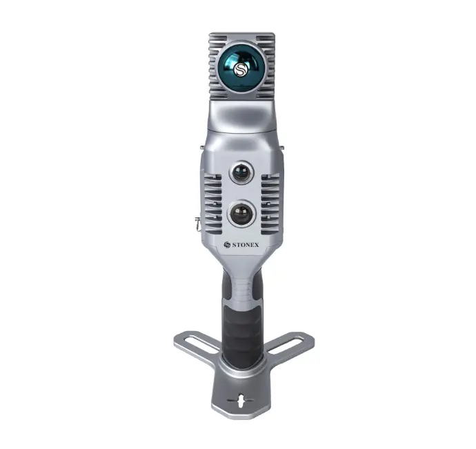
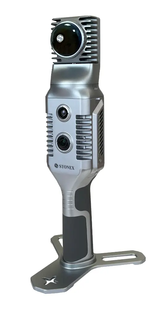
Stonex X70GO SLAM Laser Scanner
x70GO SLAM Laser Scanner + PointCab Essential (12 months)
-LiDAR, SLAM technology
-70 meters range
-12 megapixels
-Relative accuracy: 6mm
-Scanning Point Frequency: 200.000 / scan
-GOapp + GOpost applications (for free)
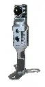
X70GO is a real-time 3D model reconstruction device which integrates inertial navigation module, high performance computer and storage system. It is equipped with a 360° rotating head, which, combined with the SLAM algorithm, generates high-precision point cloud data. A 12MP RGB camera provides texture information, while a visual camera guarantees stronger real time preview with GO. Mapping results are generated immediately inside the scanner, right after scanning: choose if you want to color them and improve their accuracy, postprocessing with GOsoftware.
GOapp
GOapp is a mobile app for Stonex SLAM scanners for project management, real-time point cloud display, image preview, firmware update and other operations. The APP runs on Android and Ios operating systems.
GOpost
Post-processing software for Windows that performs optimization processing, point cloud coloring and panoramic image creation. You can also import control points to georeference the point cloud.
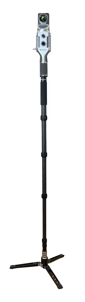
X-WHIZZ MODE
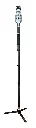
X70G0 merges mobile and stationary surveying. To the advantageous SLAM solution that allows you ot survey large areas in a very short time, ti combines a stationary mode to scan with higher resolution. Mount X70GO on a monopod and stand still in key areas for a few seconds. tI si the perfect trade-off for those who need speed and detail in a mobile survey.
REAL TIME RESULTS
The built-in visual camera makes the real time SLAM algorithm more stable, especially in weak structural textures environments. The data are ready to be used as soon as the survey is completed.
RAPIDITY AND REDUCED WORKLOAD
No more multiple scanning stations, just move around the scene to collect the entire 3D point cloud without wasting time aligning point clouds.
AUTOMATIC CONTROL POINT MEASUREMENT
When capturing data, X70GO si able to collect reference points too. They can be matched with known control points to georeference the scans.
LARGE PROCESSING CAPACITY
The system can directly output the mapping results after the acquisition si completed. You can choose to post-process the data, in case you desire to improve its accuracy.
Technical specification
X70GO Documentation
Click on the icon to download!
SYSTEM
|
Relative accuracy |
6mm(depending on the environment) |
|
Reference point support |
Ground & wall |
|
Data storage |
512GB SSD |
|
Communication |
Wi-fi, USB type-c, LEMO |
|
Operating mode |
SLAM mode Static mode (X-Whizz)
|
|
Processing mode |
Real time processing Post-processing with GOpost 2
|
ELECTRICAL SPECIFICATION
|
Power consumption |
20W |
|
System supply voltage |
20V |
|
Operating time |
1.7 h (single battery) |
|
Battery input voltage |
5-20V |
|
Battery output voltage |
10.8V |
|
Battery capacity |
3000mAh |
PHYSICAL SPECIFICATION
|
Weight |
925 g (Without battery) 1450 g (With battery) |
|
Size |
364.5 mm x 173.8 mm x 170 mm |
|
Operating temperature |
-20°C to +50°C (-4°F to 122°F) |
Storage temperature | -40°C to +70°C (-40°F to 158°F) |
|
Operating humidity |
<95% |
|
Waterproof/Dustproof |
IP54 |
LIDAR
|
Max Range |
70m@80% |
|
Min Range |
0.1 m |
|
Scanning Point Frequency |
200.000 pts/s |
|
Field of view |
360°H, -7∼52°V |
|
Laser Class |
Class 1 |
|
Wavelength |
905nm |
Frame rate | 10 Hz |
Color Camera
N° of pixels | 12 Mpx |
Diagonal FOV | 210° |
Focal length | 1.26 mm |
Resolution | 4000x3000 px |
Sensor size | 1 inch |
Pixel size | 1.55 μm |
Visual Camera
|
N° of pixels |
12 Mpx |
|
Diagonal FOV |
100° |
|
Focal length |
3.24 mm |
|
Resolution |
4000x3000 px |
|
Sensor size |
1 inch |
|
Pixel size |
1.55 μm |