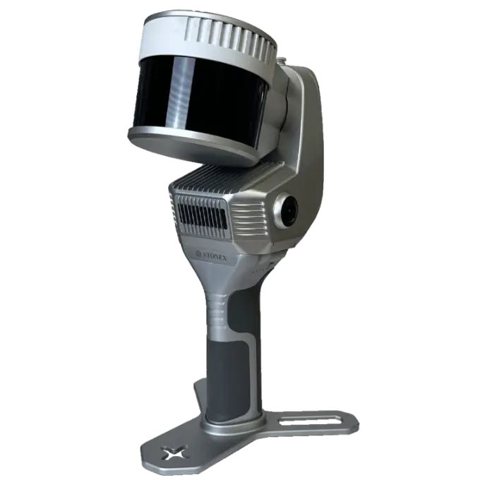
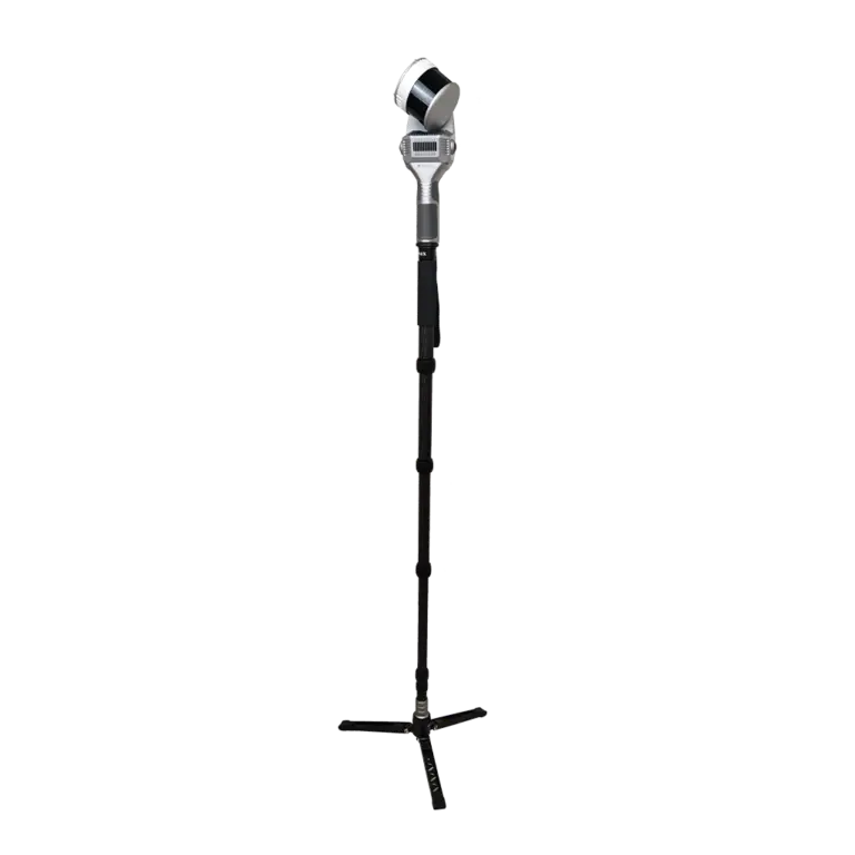
Stonex X200GO SLAM Laser Scanner
• FOV 360°x270°
• Single Ret.: 640.000 pts/s
• Dual Ret.: 1.280.000 pts/s
• Triple Ret.: 1.920.000 pts/s
• 2 cameras
• Min range 0.5m
• Max range 300m
• Automatic measuring control points
The X200GO is the latest generation system based on SLAM technology, able to meet the needs of every customer. A range of up to 300 metres and a rotating head that maximises the coverage of the laser beam make it versatile for use in all environments. The X200GO has 2 cameras and RTK receiver. X-Whizz mode, real-time point cloud colouring.
Technical specification
X200GO documentation
Click on the icon to download!
GOapp
GOapp is a mobile app for Stonex SLAM scanners for project management, real-time point cloud display, image preview, firmware update and other operations. The APP runs on Android and Ios operating systems.
GOpost
Post-processing software for Windows that performs optimization processing, point cloud coloring and panoramic image creation. You can also import control points to georeference the point cloud.
SYSTEM
|
Relative accuracy |
6 mm depending on the environment |
|
Reference point support |
Ground & wall |
|
Data storage |
512GB SSD |
|
Communication |
Wi-fi, Bluetooth, USB type-c, Lemo connector |
|
Operating mode |
SLAM mode, X-whizz mode, real-time visualisation |
|
Processing mode |
Real-time processing Post-processing with GOpost 2 |
ELECTRICAL SPECIFICATION
|
Power consumption |
26W |
|
System supply voltage |
20V |
|
Operating time |
1.7 h (single battery) |
|
External power |
USB Tyce-c |
|
Battery input voltage |
5-20V |
|
Battery output voltage |
10.8V |
|
Battery capacity |
3000mAh |
PHYSICAL SPECIFICATION
|
Weight |
0,65 kg (Without battery) 1,9 kg (with battery) |
|
Size |
403 mm x 173.8 mm x 170 mm |
|
Operating temperature |
-20°C to +50°C (-4°F to 122°F) |
|
Operating humidity |
<95% |
|
Waterproof/Dustproof |
IP54 |
GNSS vevő
|
Műhold jel |
GPS L1 C/A/L2P(Y)/L2C/L5 GLONASS G1/G2 Galileo E1/E5A/E5B BDS B11/B21/B31 QZSS L1/L2/L5 |
|
DGPS (RMS) |
Horizon 0.4 m+1 ppm |
|
RTK (RMS) |
Horizon 0,8 cm+1 ppm |
|
Gyorsaság pontosság |
0,03m/s |
LIDAR
Szenzor | Hesai TX32M2X |
|
Max Range |
300 m |
|
Min Range |
0.5 m |
Return number | 3 |
|
Scanning Point Frequency |
SingleRet: 640.0pls/5 |
|
Field of view |
360° x 280° |
|
Laser Class |
Class 1 |
|
Wavelength |
905nm |
Color Camera
|
N° of pixels |
24 Mpx (2 db 12 Mpx-es kamera) |
|
Diagonal FOV |
210° |
|
Focal length |
1.26 mm |
|
Resolution |
4000X3000 px |
|
Sensor size |
1/2.3 inch |
|
Pixel size |
1.55 μm |