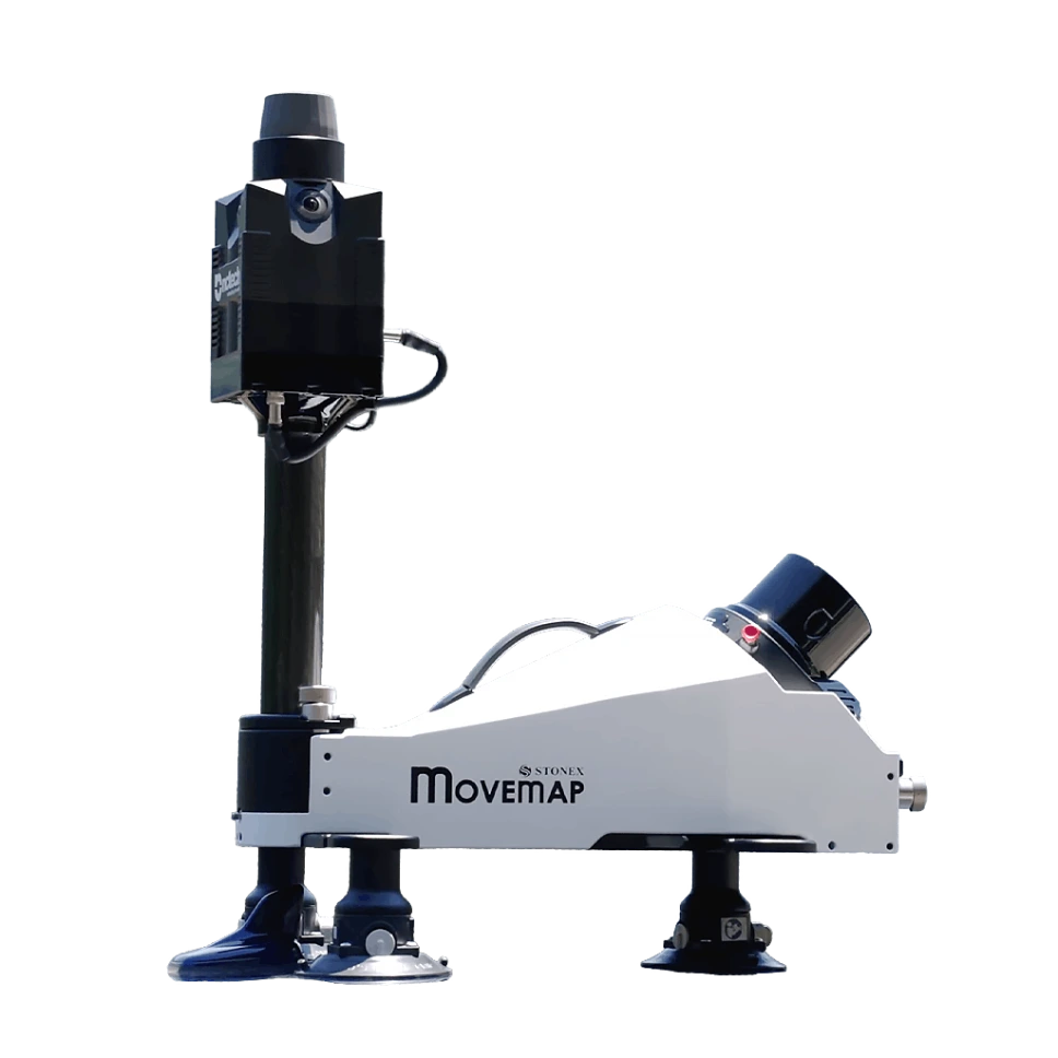
ALL-IN-ONE SOLUTION
A fully integrated system that combines hardware, software, and data processing workflows into a single, unified solution. From data acquisition to final deliverables, every component works in perfect harmony, reducing complexity and setup time.
No need for multiple separate devices or third-party integrations: everything is optimized for simple, efficient, and reliable operation, as well as consistent results across every project.
TOOL-LESS BY DESIGN
The system features a fully integrated design, with no loose cables to manage and no tools required for assembly. The entire system can be set up in just a few seconds – arrive on site and start scanning immediately.
INTUITIVE CONTROL. COMPLETE CONFIDENCE.
The user-friendly WebApp clearly displays all essential information – everything you need is exactly where you would expect it, ensuring a fast and error-free field workflow.
Back in the office, the Cube-map software, with its multiple modules and advanced features, provides a complete solution tailored to your needs. Clear and intuitive visual reports provide comprehensive quality control.
USER-CONTROLLED BORESIGHT CALIBRATION
Boresight calibration ensures maximum georeferencing accuracy of the point cloud by precisely determining the angular offsets between the INS and each sensor.
The system allows users to perform boresight calibration independently, eliminating the need for manufacturer intervention.
Technical specification
X120GO Documentation
Click on the icon to download!
SYSTEM
|
Configurations |
Vehicle, standard UAV, DJI M300/M350, backpack |
|
LIDAR Sensor |
Hesai XT32M2X |
Max Range |
300 m |
Min Range |
0,5 m |
Return number | 3 |
Scanning Point Frequency | 640 000 pts/s (single return) 1 280 000 pts/s (dual return) 1 920 000 pts/s (triple return) |
Laser Class | Class 1 eye-safe per IEC/EN 60825-1:2014 |
Channels | 32 |
Wavelength | 905nm |
Camera
Specification | Car/backpack |
UAV |
N° of pixels | 60,5 MP |
24 MP |
FOV | 360° | - |
Focal Length | 16 mm | - |
Sensor size | 23,5 × 15,7 mm |
GNSS
Satellites constellations |
GPS / GLONASS / Galileo / BeiDou / SBAS / QZSS |
Channels |
336 |
Operating mode |
PPK |
IMU
Data rate |
200 Hz |
Accuracy¹ – Roll/Pitch |
0,025° |
Heading | 0,08° |
ELECTRICAL SPECIFICATION
Specification | Car/backpack | UAV |
Power consumption | 30 W | - |
System supply voltage | 12–24 V | - |
Operating time (single battery) | 2h (hot swappable) | - |
BU Battery | ✔ | - |
Battery input voltage | 14,4 V | - |
Battery capacity | 6900 mAh | - |
External power | Lemo | Skyport |
PHYSICAL SPECIFICATION
Weight | 14,5 kg |
Size | 714 × 594 × 417 mm |
Operating temperature | -10°C to +40°C (14°F to 104°F) |
Waterproof/Dustproof | IP55 |
System capacity
Precision¹˒² | 3 cm |
Accuracy¹˒² | 3 cm |
Data storage | 256GB – External USB 3.2 Flash Drive |
Communication | Wi-Fi |
Operating mode | Capacitive touch button |
Web interface | WebApp |
Processing mode | Cube-map |